• Skip to primary navigation
  • Skip to main content

CINA.

  • About
    • Mission
    • People
  • Research
    • Research
    • Projects
    • RFPs
  • Education
    • Resources
    • Internships
  • Publications
    • Newsletter Archive
    • Director’s Blog
  • News & Events
    • News
    • CINA Director’s Blog
    • Digital Archive
    • Events
    • Work with Us
  • Contact
  • Search Toggle
  • Skip to content

Detecting and mapping slums using open data: a case study in Kenya

Dec 2018

  • Journal Article

International Journal of Digital Earth
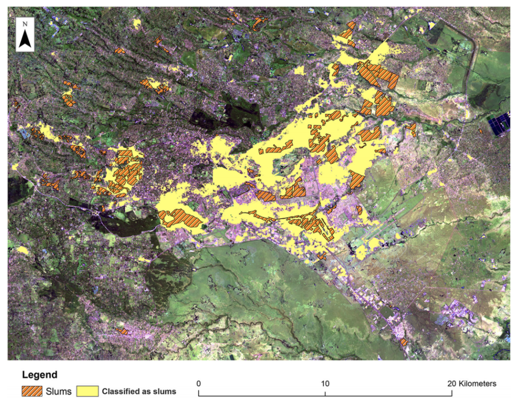
The worldwide slum population currently stands at over one billion, with substantial growth expected in the coming decades. Traditionally, slums have been mapped using information derived mainly from either physical indicators using remote sensing data, or socio-economic indicators using census data. Each data source on its own provides only a partial view of slums, an issue further compounded by data poverty in less-developed countries. To overcome such issues, this paper explores the fusion of traditional with emerging open data sources and data mining tools to identify additional indicators that can be used to detect and map the presence of slums, map their footprint, and map their evolution. Towards this goal, we develop an indicator database for slums using open sources of physical and socio-economic data that can be used to characterize slum settlements. Using this database, we then leverage data mining techniques to identify the most suitable combination of these indicators for mapping slums. Using three cities in Kenya as test cases, results show that the fusion of these data can improve the mapping accuracy of slums. These results suggest that the proposed approach can provide a viable solution to the emerging challenge of monitoring the growth of slums.

Citation:

Mahabir, R., Agouris, P., Stefanidis, A., Croitoru, A., & Crooks, A. T. (2018). Detecting and mapping slums using open data: a case study in Kenya. International Journal of Digital Earth, 1-25.

Authors

  • Anthony Stefanidis
  • Ron Mahabir
  • Peggy Agouris
  • Arie Croitoru
  • Andrew Crooks
Publication Download

Topics:

  • Geospatial
  • Open source data

Research Areas:

  • Spatiotemporal patterns

*The programs and services offered by George Mason University are open to all who seek them. George Mason does not discriminate on the basis of race, color, religion, ethnic national origin (including shared ancestry and/or ethnic characteristics), sex, disability, military status (including veteran status), sexual orientation, gender identity, gender expression, age, marital status, pregnancy status, genetic information, or any other characteristic protected by law. After an initial review of its policies and practices, the university affirms its commitment to meet all federal mandates as articulated in federal law, as well as recent executive orders and federal agency directives.

CINA Now

Events

All Events

Publications

The Key to Deobfuscation is Pattern of Life, not Overcoming Encryption

Published: Oct 4, 2025

The Organized Activities of Ransomware Groups: A Social network Approach

Published: Mar 14, 2025
All Publications

News

CINA Distinguished Speaker Series with Colton Seale: Interviewer Mindset

CINA  |   April 3, 2025  |   Posted In:
  • Digital Archive
  • Uncategorized

CINA  |   March 6, 2025  |   Posted In:
  • Uncategorized
All News

Science and Technology Directorate’s Office of University Programs
CINA at George Mason University Logo
Copyright © 2025 All Rights Reserved | CINA Is A Department of Homeland Security Center of Excellence led by George Mason University
  • Facebook
  • Twitter
  • Instagram
  • Linkedin
  • YouTube